Current Projects
Testing the performance of a salmon habitat river restoration project using a scaled model
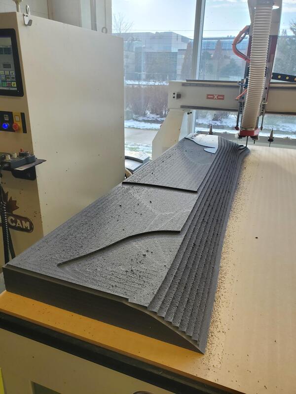
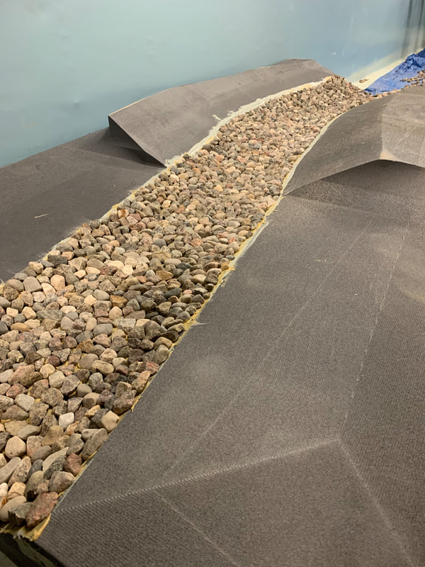
The Penticton Creek project in British Columbia is a river restoration project to restore salmon habitat in a small urban stream. Although a channel design has been proposed, there remain questions about the stability of the fine gravel that is proposed to be placed in the channel to provide spawning habitat for salmon, especially during large floods. In other words, how will the spawning gravel re-arrange in the channel? or will be washed away during floods? and what size of gravel will be the most stable? To answer these questions, an exact replica of the proposed channel design scaled at 1:30 was carved out of waterproof foam and placed in a large flume The scaled channel model provides the perfect environment to test different sizes and placement arrangements of the spawning gravel and how it will perform under different magnitude floods.
Quantifying erosion sensitivity to future land-use and climate change at the watershed scale
|
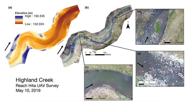
In a collaboration with Dr. Bruce MacVicar (University of Waterloo), the Research Council of Canada, and the Toronto and Region Conservation Authority (TRCA), this project aims to improve erosion risk assessment in urban watersheds using the Stream Power Index for Networks ('SPIN') tool. SPIN is a custom GIS-based toolbox that calculates the stream power, a measure of the energy of the flowing, across an entire river network using relatively simple inputs. The Humber River watershed is being used as a case study to improve the tool functionality and to explore how stream power trends relate to on-the-ground erosion risk. The novelty of the SPIN tool is that it can provide information on both current river conditions, as well as future land-use and climate change scenarios, providing municipalities and conservation authorities important information to help guide watershed management decisions.
|
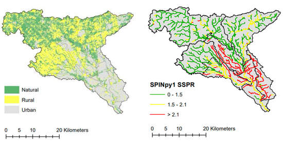
Land-use and stream power maps of the Humber River watershed under current conditions.
|
Assessing surface water erosion along the Niagara Escarpment
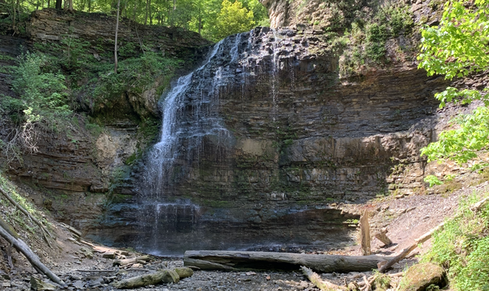
Tiffany Falls in Hamilton, ON.
|
The Hamilton area includes many regionally important streams such as Ancaster Creek, Chedoke Creek, and Red Hill Creek. As these streams flow over the Niagara Escarpment, they provide an impressive array of waterfalls that are a significant recreational attraction. In fact, with over 100 waterfalls, Hamilton is the "Waterfall Capital of the World"! Surprisingly, little is known about the unique geomorphology of these streams and their relationship with erosion along the escarpment face. This project aims to characterize the geomorphology of these stream networks and to investigate their contribution to escarpment erosion through processes such as freeze-thaw and hydraulic erosion.
|
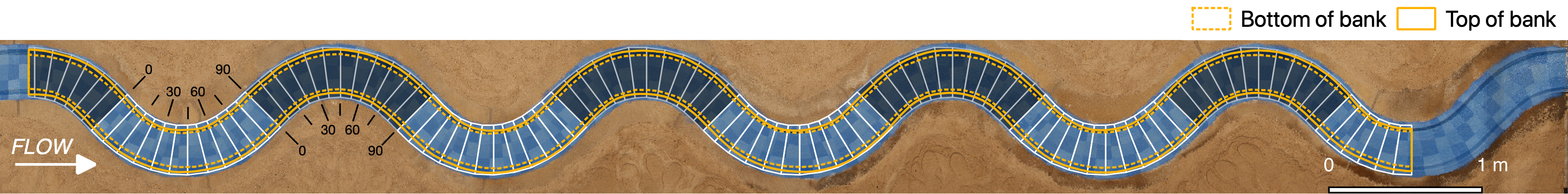
How do we measure geomorphology?
|
River assessments are an important step for all restoration, conservation, and management projects, as they provide information on the starting condition of rivers as well as for monitoring changes. A review of 91 river assessment procedures from around the world identified a large variability in which geomorphic processes are measured and how. Moreover, there is a lack of quantitative tools available for incorporating geomorphology in river assessment and monitoring programs. This project aims to improve how geomorphology is measured and incorporated into river assessment and management projects by 1) quantifying the error and variability associated with different assessment procedures, and 2) developing and testing new assessment tools using the most recent advances in geomorphology science and technology.
|
Data collection using drone imagery.
|
GeoTrails: Sharing geoscience knowledge
Through a collaboration with the APGO Education Foundation, interesting geoscience information and results from research around the Hamilton area are shared through virtual field trips on GeoscienceINFO. Given the cultural and recreational importance of the Niagara Escarpment, these publically-available online recourses aim to increase awareness of the scientific importance of this unique environment.
Past Research Highlights by Dr. Papangelakis
Can you feed sediment to a river to 'fix' it?
In 2020, I worked as a Postdoctoral Associate in the Department of Geography and Environment at The University of Western Ontario under supervision of Dr. Peter Ashmore. The project focused on semi-alluvial rivers, which have a mobile layer of alluvial material (sand and gravel) that is transported over an immobile bed. This immobile bed is often bedrock, but can also be dense clay and silt like what in Southern Ontario rivers. The alluvial layer is important because it protects the underlying material from erosion and provides the building blocks for aquatic habitats. This project used experiments in a model meandering channel built in a flume to explore how the alluvial layer forms and evolves under different flow and sediment supply conditions. Both water and sediment was fed through the channel, and photogrammetry was used to create 3D maps of the alluvial layer as it formed and changed. The aim was to replicate the processes that occur in semi-alluvial beds in order to assess artificial sediment augmentation (or adding sediment to rivers) as a tool for restoring urban semi-alluvial rivers.
Overhead image of the experimental set-up showing the empty channel. Sediment was fed at the upstream (left) end of channel.
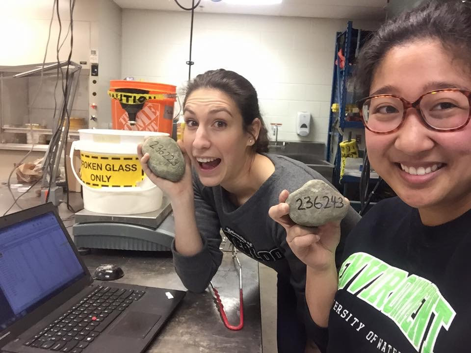
How urbanization, stormwater management, and river restoration affect bedload sediment transport
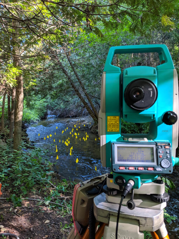
My doctoral research, supervised by Dr. Bruce MacVicar, was completed through the Collaborative Water Program in the department of Civil & Environmental Engineering at the University of Waterloo. The focus of her work was on the effects of urbanization and various river management strategies on the transport of bed load sediment. A total of 1,500 RFID-tagged tracer stones across three rivers in the Toronto area were tracked to capture how bed sediment travels downstream during floods. The project was nestled within a larger, interdisciplinary project that attempted to understand urban river systems and improve river management practices. Sediment transport is an important river process that is currently not directly accounted for in most restoration design, resulting in high rates of project failure and the continued loss of ecological health. Results from this project provide insights and tools into how to incorporate sediment transport into river management decisions.
|
Elli Papangelakis, PhD
Assistant Professor, Fairley Gadsby Research Chair in Fluvial Geomorphology Office: General Science Building, 231 Email: [email protected] Google Scholar - ResearchGate - Twitter |
School of Earth, Environment & Society McMaster University 1280 Main St. West, Hamilton, ON 
|